Launch week for A World Transformed: Exploring the Spirituality of Medieval Maps, begins Monday (April 27)! I’ve talked so much about Jerusalem centering medieval maps, and you can read all about it in the book. So why don’t we branch out and explore some different places on the maps? From the zany to the serious, this list showcases the diversity of the medieval world.
1. An emoticon island
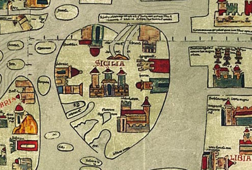
On the Ebstorf Map, the island of Sicily is for lovers! It’s a great example of cordiform geography (“cordiform” being one of my new favorite words).
2. A classical labyrinth
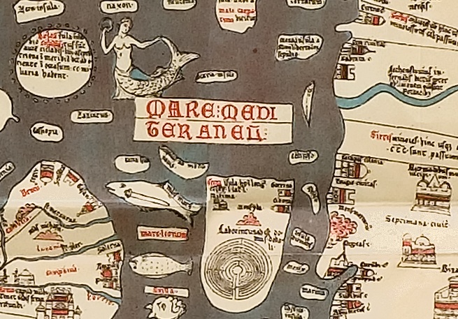 On the Hereford Map, we see the labyrinth built by Daedalus on the island of Crete. The Athenian hero Theseus found his way through the labyrinth and killed the Minotaur that was imprisoned there. It’s not quite the meditative journey we think about in relation to walking the labyrinth today! (And yes, that’s a mermaid swimming in the Mediterranean Sea above.)
3. A colorful sea
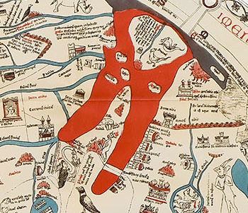 In Asia, the Red Sea is literally colored red on the Hereford Map. It’s one of the easiest places to spot on the map. (Just look at the cover of my book, where the Red Sea vies for attention with the title itself!) At the bottom, the sea has been parted to show the miraculous event that let the Israelites pass through on dry land. For more on this journey, see my earlier blog post.
4. A forbidden garden
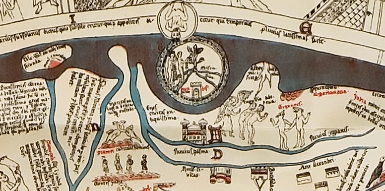
In the Middle Ages, the Garden of Eden, known as Earthly Paradise, was thought to be a physical location on earth. It is plotted at the top of medieval maps, at their easternmost point. Eden is often depicted as a circular garden showing the story of Adam and Eve . . . and plenty of monsters.
5. Three desert monasteries
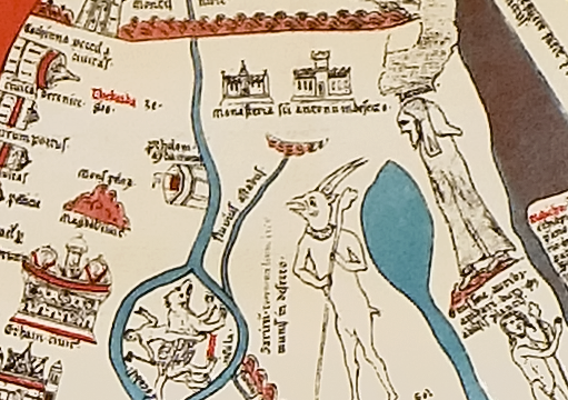
Monsters aren’t the only thing on the edge of the world. On the rim of medieval Africa/Asia are the monasteries of St. Anthony, one of the first desert fathers (the third monastery, on the far right, is obscured by damage to the Hereford Map). Just below the monasteries roams a satyr, one of the beasts that tempted the saint.
6. An anti-Eden
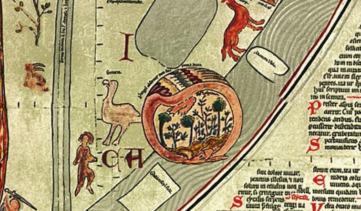 Near the southwestern tip of Africa on the Ebstorf Map lies the Garden of Hesperides, encircled by a feathered dragon. In Greek mythology, this garden contained a tree with golden apples, a wedding present to Zeus and Hera. It is sometimes known as the Greek Eden or an anti-Eden.
7. The setting sun
 At the western edge of the world, we see the tow columns erected by Hercules during his labors. This is as far as you can go! Beyond these columns lies the great unknown.
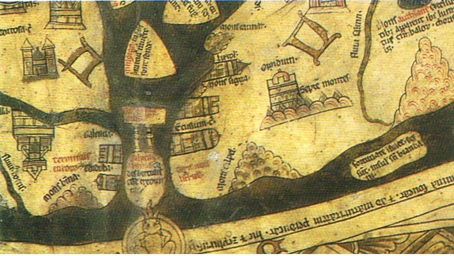
8. The city of lights
 Paris is always worth a visit, right? On the Hereford Map, Paris is the largest city on the continent of Europe. On the whole map, it is second in size only to the Towel of Babel. Paris and Babel . . . hmmm. Interesting connection. The scratch marks on Paris are the cause of speculation–are they the result of anti-French sentiments in England, where the map was made? Or just from something cutting into the parchment?
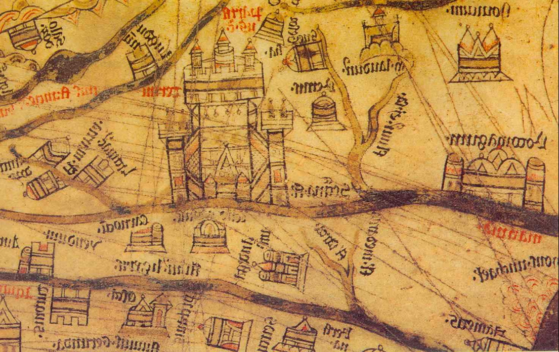
9. The camp of a conqueror
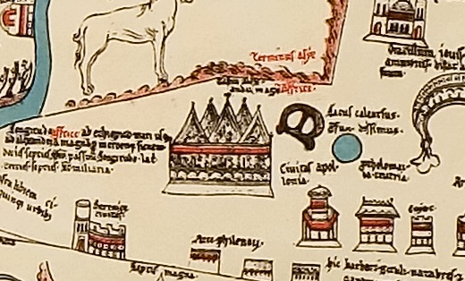
If Paris seems too mundane (been there, done that), pay a visit to the camp of Alexander the Great, who conquered the world. The tent’s location on the border of Asia and Africa probably alludes to Alexander’s subjugation of the African continent.
10. O little town
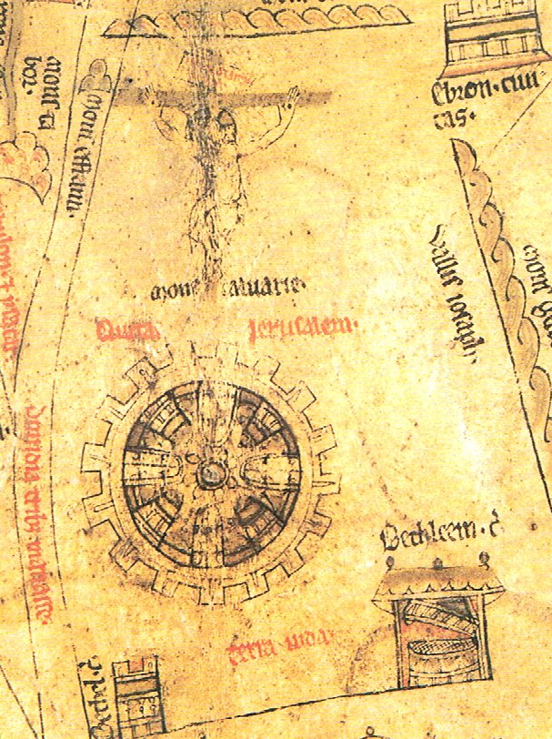
I’ve spoken many times of the cross at the center of the Hereford Map. But the map also pictures Bethlehem, in the lower right of the picture above, where Jesus was born. The beginning and end of Jesus’ earthly life are very close on the map. It all comes together in the center of the world!
What’s your favorite site on medieval maps?
So interesting, Lisa. Your insights are amazing.
Thanks, Dianne. So many great places on the maps!